
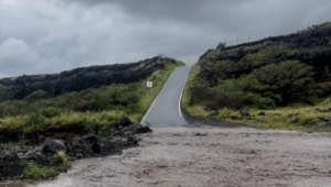
The rain-drenched Hawaiian Islands are bracing for another deluge Thursday, less than a week after a record-breaking storm buckled roadways and collapsed buildings. More than 5 feet of rain fell in some parts of Maui from March 10 to 16, according to the University of Hawaii’s climate data team. Some 33 inches fell in just 24 hours at Haleakalā crater, near the island’s summit.
Although the coming storm is weaker than the prior one, National Weather Service forecasters have said it won’t take much to restart the flooding. Much of Hawaii is under flood watch. “Given the high soil saturation from the recent kona storm, even moderate rainfall rates could pose a risk for rapid runoff and flooding,” NWS forecasters said Thursday.
A kona storm is a Hawaiian weather pattern that can cause heavy rainfall on typically dry, leeward areas of the islands that are usually sheltered from such precipitation. The anticipated rain this week is from a new kona storm. These storms are interacting with a different type of disaster in Hawaii — wildfires — with compounding effects.
The regions of the islands that get pounded by ferocious rains from kona storms are the same regions where wildfires have become more common over the past several decades. When rain hits the fire-affected areas, it triggers runoff and erosion, worsening flooding and raising the risk of mudslides.